 ,
and in the overlook east of the tunnel.


 .
. Yosemite Hiking Tips by Brian, Founder of OutsideHow.com
Here is a photo essay of that great weekend. Friday
afternoon June 14th, we arrived in Yosemite Valley (map).
On my way in from Route 41, I could see our target - Half Dome - before the
tunnel
 ,
and in the overlook east of the tunnel.


 .
.
We got in early enough to pick up our reserved
wilderness permits, at the Yosemite Valley Wilderness Center in Yosemite
Village next to the post office. We then set up camp in the backpackers
walk-in campground (just north of North Pines Campground).
 You must have a wilderness permit to stay here, (you can stay the day before,
and the day after, of your wilderness outing) and self-registration is $5 a
person a day. A bear visited the camp that evening, We were careful
to put all items with odor into a bear box provided. We didn't need our plastic bear
canister on this hike, because boxes were amply provided. You can buy
then at Yosemite,
REI
online, or recently at $18 less at
Whitney
Portal Store.
Saturday, June 15th, 2002, we headed up from
the Happy
Isles Trailhead
 from the backpacker's
parking lot, where, once again, there are plenty of bear boxes to store
things so bears will not rip open your vehicles during your absence.
Base elevation was 4000 feet. Half Dome peak is 8.2
miles one way
 ,
8845 feet elevation (almost a mile higher than the valley, for a 4845 foot
elevation gain). Our original idea was to hike the entire John Muir Trail
on my very first overnight - 211 miles!
 Common sense got to us before the bears and elements. We stayed overnight
in Little Yosemite Valley, about half way to the top of Half Dome.
Here is a good summary for anyone thinking of hiking Half Dome.
Our packs included things from this checklist.
Going up, we hiked over the bridge at the base of Vernal
Fall

 ,
along the Merced River
 and up to the slippery Mist Trail

 ,
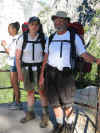
to the top of Vernal Fall
 ,
and then on up
 to the top of Nevada Fall

 .
We saw a nice rainbow over the Merced on this path


 .
.
Coming back, we will take the John Muir Trail down, which is more easily navigated, and offers outstanding views of the Valley.
This is Little Yosemite Campground
 ,
along the Merced River. It was new, and very nice and clean, with good
"clean" composting toilets available, and bear boxes. Deer
walked among us here.

We replenished our water (you need at least a gallon to do
Half Dome as a day trip, and many hikers were dehydrated). We both pumped
(filtered) and treated (iodine tablets) our water just to be safe. We got
water from the Merced River, and once again on the way to Half Dome (just past
Sunrise Creek Trail) we found a reliable spring
 .
.
A Black Bear welcomed us

 on the path to Half Dome


 .
.
At the base of Half Dome, just before the
"cables" start

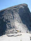 you can see people working their way up the cable walkway. Make sure
you bring good rubber coated-cloves (not for warmth, but to keep hold of the
steel cables), and wear good hiking boots with traction. A lot of gloves
are available on the ground at the base, but it is better to bring a good pair
yourself. Tennis shoes are too slippery to use with safety. I wanted
(but did not have) a carabiner tied to my waist to have just in case I
fainted, and needed to hook-up to the cables. Sandy dropped a full Nalgene
water bottle from the top of the cables, and we watched in horror as it bounced
a few times, finally exploding 2000 feet below.
No photos were taken from the
cables, as all hands were occupied and worthless for any task unrelated to
survival, Arriving at the top we were rewarded with outstanding views


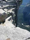
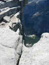
 . We met some new friends

 .
.
At the same time we were feeling so good about our
accomplishment, we observed some real climbers completing the ascent of on the
north face, just yards below us (it made us sick to even look)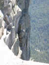 .
I do not know how the human body conditions itself to do such a thing.
Anyway we made it to the top, as proven in this photo
 !
!
We made it back to Little Yosemite Campground to stay Saturday night... and completing our food preparations just before dark, when the bears like best to charge people for their dinner.
Sunday, June 16th, 2002, we headed back down.
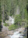
Taking the John Muir Trail instead of the Nevada/vernal Falls Trails afforded
grand views of Nevada Fall with Mt. Broderick,


 ,
and the Valley welcoming us below
 .
.
At the time, we said (or at least I did) that we'd probably never do Half Dome again - it was just too scary - but I yearn to return.
We camped once again at the backpacker's campground Sunday night. Had pizza at Camp Curry that evening (enough of Gorp and dehydrated foods!)
Monday, June 17th, 2002 we awoke, walked to Mirror Lake, and bought ourselves some gifts in the Curry Village mountaineering shop (trekking poles, CamelBak hydration systems...) as rewards for a hike well-done. Hit the highways to our homes... how little we missed the traffic, news, and noise of civilization.
Note: Prior to this weekend, I walked around Sequoia National Park, and attempted to hike up snow-covered Alta Peak in Sequoia National Park... a photo essay of that segment may be forthcoming, with a link to be published here.
August 14, 2005, Mike Nix and I (Mike Baird) attempted to do Half-Dome again. Mike Nix made it all the way to the top, but he had to return immediately due to thunder and rain. I (Mike Baird), was too tired to attempt the final cable assault, so I took some pictures of the final climb from the base. None of these pictures turned out so swell that I wanted to post them permanently here... at one time you could can see them temporarily at PolaroidPics.com (including some from Sequoia National Park, trip to Cahoon Gap)... but, PolaroidPics shut down operations 9-05.
back to mikebaird.com home